Projet de numérisation du fonds cartographique du laboratoire de graphique

[Annotation #642187]

Annotation

Propriétaire

Créé

2019-02-04 15:39:45

Métadonnées

Motivated by

locating

styledBy

{"leaflet-interactive":{"style":"","pane":"overlayPane","attribution":"","bubblingMouseEvents":"true","fill":"true","smoothFactor":"1","noClip":"false","stroke":"true","color":"#34495e","weight":"3","opacity":"1","lineCap":"round","lineJoin":"round","dashArray":"10, 10","dashOffset":"","fillColor":"","fillOpacity":"0","fillRule":"evenodd","interactive":"true"}}
Bodies

#1

value

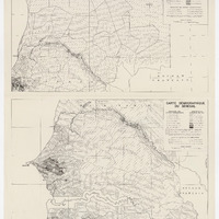
Emprise de la carte

hasPurpose

describing

Targets

#1

type

oa:Selector

Format

application/wkt

value

POLYGON ((-16.887311 19.77615, -16.466351 19.775426, -15.001417 19.792881, -12.999228 19.810015, -12.003268 19.80732, -9.304677 19.783704, -7.094185 19.761886, -7.11042 17.521809, -7.140653 16.016232, -7.173281 14.294008, -7.989786 14.303477, -8.997155 14.316634, -11.003983 14.339426, -13.001734 14.346727, -14.997863 14.331313, -16.751558 14.315899, -16.811998 14.314141, -16.817541 15.005884, -16.868381 18.013261, -16.887311 19.77615))

styleClass

leaflet-interactive

Uncertainty

Known