[Annotation #642189]
Annotation
Métadonnées
Motivated by
locating
styledBy
{"leaflet-interactive":{"style":"","pane":"overlayPane","attribution":"","bubblingMouseEvents":"true","fill":"true","smoothFactor":"1","noClip":"false","stroke":"true","color":"#34495e","weight":"3","opacity":"1","lineCap":"round","lineJoin":"round","dashArray":"10, 10","dashOffset":"","fillColor":"","fillOpacity":"0","fillRule":"evenodd","interactive":"true"}}
Targets
#1
type
oa:Selector
Format
application/wkt
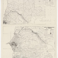
value
POLYGON ((-18.040058 16.981988, -14.99562 16.982558, -13.004099 16.98207, -10.946427 16.983532, -10.9673 15.002449, -10.990799 12.99505, -10.998163 11.99978, -11.996466 11.999251, -12.998137 12.000213, -13.999809 12.000213, -16.00296 11.998865, -16.994813 12.000213, -17.879242 12.000213, -18.039417 12.002908, -18.039032 12.185801, -18.041823 12.992981, -18.040828 15.996552, -18.040572 16.933217, -18.040058 16.981988))
styleClass
leaflet-interactive
Uncertainty
Known