Projet de numérisation du fonds cartographique du laboratoire de graphique

[Annotation #642235]

Annotation

Propriétaire

Créé

2019-02-04 16:42:27

Métadonnées

Motivated by

locating

styledBy

{"leaflet-interactive":{"pane":"overlayPane","attribution":"","bubblingMouseEvents":"true","color":"#34495e","dashArray":"10, 10","fillOpacity":"0","fill":"true","smoothFactor":"1","noClip":"false","stroke":"true","weight":"3","opacity":"1","lineCap":"round","lineJoin":"round","dashOffset":"","fillColor":"","fillRule":"evenodd","interactive":"true"}}
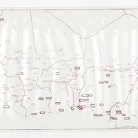
Bodies

#1

value

Emprise de la carte

hasPurpose

describing

Targets

#1

type

oa:Selector

Format

application/wkt

value

POLYGON ((-25.451825 24.329134, -18.153794 24.295525, -10.452451 24.31473, -5.397245 24.330935, 4.327861 24.35014, 15.135669 24.364544, 21.347397 24.316531, 27.53752 24.232507, 27.523116 23.118597, 27.513513 18.732577, 27.523116 14.032069, 27.575931 7.254983, 27.692363 2.122355, 12.700191 2.040732, -5.535639 2.037741, -14.211297 1.935103, -19.785649 1.882288, -22.080687 1.901493, -25.754309 1.908095, -25.771114 5.409469, -25.771114 8.794411, -25.732703 15.422656, -25.636677 19.830282, -25.451825 24.329134))

styleClass

leaflet-interactive

Uncertainty

Known