[Annotation #642271]
Annotation
Métadonnées
Motivated by
locating
styledBy
{"leaflet-interactive":{"pane":"overlayPane","attribution":"","bubblingMouseEvents":"true","color":"#34495e","dashArray":"10, 10","fillOpacity":"0","fill":"true","smoothFactor":"1","noClip":"false","stroke":"true","weight":"3","opacity":"1","lineCap":"round","lineJoin":"round","dashOffset":"","fillColor":"","fillRule":"evenodd","interactive":"true"}}
Targets
#1
hasSource
type
oa:Selector
Format
application/wkt
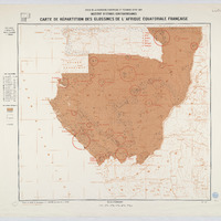
value
POLYGON ((6.997544 4.00155, 16.003264 3.995787, 19.002149 4.000765, 18.996718 1.996757, 18.993098 -0.00182, 19.004864 -3.999503, 18.999232 -7.001454, 16.99563 -7.003756, 13.99852 -7.00018, 9.99562 -7.000896, 7.005384 -7.002114, 6.992742 -3.997416, 7.007432 1.003703, 6.997544 4.00155))
styleClass
leaflet-interactive
Uncertainty
Known