Projet de numérisation du fonds cartographique du laboratoire de graphique

[Annotation #642490]

Annotation

Propriétaire

Créé

2019-02-13 15:45:28

Métadonnées

Motivated by

locating

styledBy

{"leaflet-interactive":{"pane":"overlayPane","attribution":"","bubblingMouseEvents":"true","color":"#34495e","dashArray":"10, 10","fillOpacity":"0","fill":"true","smoothFactor":"1","noClip":"false","stroke":"true","weight":"3","opacity":"1","lineCap":"round","lineJoin":"round","dashOffset":"","fillColor":"","fillRule":"evenodd","interactive":"true"}}
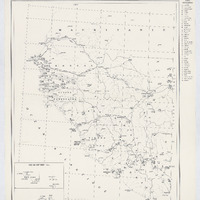
Bodies

#1

value

Emprise de la carte

hasPurpose

describing

Targets

#1

type

oa:Selector

Format

application/wkt

value

POLYGON ((-19.218836 19.075624, -17.05353 19.252141, -15.291692 19.381143, -10.904395 19.659569, -7.877135 19.818372, -5.835621 19.906735, -5.785187 18.137811, -5.640972 11.204665, -5.497591 3.75843, -9.383054 3.566283, -14.288024 3.262848, -18.075121 2.969417, -18.33104 6.514766, -18.654481 11.142977, -19.218836 19.075624))

styleClass

leaflet-interactive

Uncertainty

Known