[Annotation #642773]
Annotation
Métadonnées
Motivated by
locating
styledBy
{"leaflet-interactive":{"pane":"overlayPane","attribution":"","bubblingMouseEvents":"true","color":"#34495e","dashArray":"10, 10","fillOpacity":"0","fill":"true","smoothFactor":"1","noClip":"false","stroke":"true","weight":"3","opacity":"1","lineCap":"round","lineJoin":"round","dashOffset":"","fillColor":"","fillRule":"evenodd","interactive":"true"}}
Targets
#1
hasSource
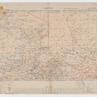
type
oa:Selector
Format
application/wkt
value
POLYGON ((18.00307 20.007316, 18.999438 19.996641, 21.999846 19.990969, 25.994378 19.990969, 30.000836 20.008856, 30.000836 19.004988, 30.00069 18.002283, 30.003308 16.565193, 30.001951 13.995728, 29.99775 11.991837, 27.996358 12.003299, 26.000021 12.007722, 23.009538 12.01025, 21.001941 12.01094, 19.000779 11.999449, 17.999623 11.989108, 17.998934 12.993136, 17.998934 14.995907, 17.999853 16.99707, 17.996176 18.003166, 18.002151 19.004896, 18.00307 20.007316))
styleClass
leaflet-interactive
Uncertainty
Known