Projet de numérisation du fonds cartographique du laboratoire de graphique

[Annotation #642781]

Annotation

Propriétaire

Créé

2019-02-16 20:36:17

Métadonnées

Motivated by

locating

styledBy

{"leaflet-interactive":{"pane":"overlayPane","attribution":"","bubblingMouseEvents":"true","color":"#34495e","dashArray":"10, 10","fillOpacity":"0","fill":"true","smoothFactor":"1","noClip":"false","stroke":"true","weight":"3","opacity":"1","lineCap":"round","lineJoin":"round","dashOffset":"","fillColor":"","fillRule":"evenodd","interactive":"true"}}
Bodies

#1

value

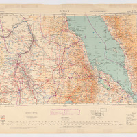
Emprise de la carte

hasPurpose

describing

Targets

#1

type

oa:Selector

Format

application/wkt

value

POLYGON ((30.002142 20.007626, 31.997266 20.004561, 34.995676 19.994428, 37.999903 19.987672, 40.004473 19.990862, 42.001911 20.000996, 43.995972 20.008502, 43.999725 19.009783, 44.000851 18.002431, 44.000101 15.997861, 44.001227 12.999452, 44.001602 11.988347, 41.998158 12.005611, 39.996216 12.007863, 38.001029 12.006362, 36.522279 12.012367, 34.99749 12.014369, 32.993796 11.998856, 31.00011 11.995353, 30.001641 11.988847, 30.001641 13.993292, 30.007146 14.998141, 30.001641 17.000584, 30.002892 19.008031, 30.002142 20.007626))

styleClass

leaflet-interactive

Uncertainty

Known