[Annotation #642853]
Annotation
Métadonnées
Motivated by
locating
styledBy
{"leaflet-interactive":{"pane":"overlayPane","attribution":"","bubblingMouseEvents":"true","color":"#34495e","dashArray":"10, 10","fillOpacity":"0","fill":"true","smoothFactor":"1","noClip":"false","stroke":"true","weight":"3","opacity":"1","lineCap":"round","lineJoin":"round","dashOffset":"","fillColor":"","fillRule":"evenodd","interactive":"true"}}
Targets
#1
type
oa:Selector
Format
application/wkt
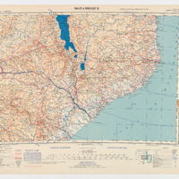
value
POLYGON ((30.001586 -11.992485, 32.001087 -12.000851, 34.998033 -12.004949, 39.000962 -12.009047, 42.001494 -11.99368, 42.001494 -15.993536, 41.99825 -20.00927, 39.999262 -20.00005, 36.999982 -19.987985, 32.996085 -19.992993, 29.996578 -20.007563, 29.997944 -18.002427, 29.998854 -16.005032, 29.999309 -13.997165, 30.001586 -11.992485))
styleClass
leaflet-interactive
Uncertainty
Known