[Annotation #642875]
Annotation
Métadonnées
Motivated by
locating
styledBy
{"leaflet-interactive":{"pane":"overlayPane","attribution":"","bubblingMouseEvents":"true","color":"#34495e","dashArray":"10, 10","fillOpacity":"0","fill":"true","smoothFactor":"1","noClip":"false","stroke":"true","weight":"3","opacity":"1","lineCap":"round","lineJoin":"round","dashOffset":"","fillColor":"","fillRule":"evenodd","interactive":"true","style":""}}
Targets
#1
hasSource
type
oa:Selector
Format
application/wkt
value
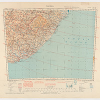
POLYGON ((23.997074 -27.990181, 24.997274 -28.000866, 26.001951 -28.003373, 28.007365 -28.009104, 30.997399 -28.007671, 33.987075 -27.999433, 36.005741 -27.991375, 36.00413 -29.255728, 36.000548 -32.413387, 36.002697 -36.007659, 35.004825 -36.003361, 32.997262 -35.995481, 30.992922 -35.991542, 28.008619 -35.993213, 25.005691 -36.005152, 23.992298 -36.010883, 23.997551 -34.00511, 23.998506 -31.101516, 23.995641 -28.713691, 23.997074 -27.990181))
styleClass
leaflet-interactive
Uncertainty
Known