Projet de numérisation du fonds cartographique du laboratoire de graphique

[Annotation #668951]

Annotation

Propriétaire

Créé

2019-02-25 15:40:36

Métadonnées

Motivated by

describing

styledBy

{"leaflet-interactive":{"stroke":"true","color":"#c0392b","weight":"4","opacity":"0.5","fill":"true","fillColor":"","fillOpacity":"0.2","clickable":"true","smoothFactor":"1","noClip":"false","lineCap":"round","lineJoin":"round","dashArray":"","dashOffset":"","fillRule":"evenodd","interactive":"true","bubblingMouseEvents":"true","pane":"overlayPane","attribution":""}}
Bodies

#1

hasPurpose

describing

value

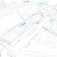
Mine de Villeranges
#2

value

Targets

#1

type

oa:Selector

Format

application/wkt

value

POLYGON ((3072.434632 1714, 3008.409999 1630, 3052.426934 1588, 3088.44079 1586, 3102.446179 1524, 3060.430013 1434, 3018.413848 1420, 3060.430013 1374, 3106.447718 1382, 3152.465424 1494, 3118.452337 1610, 3126.455416 1656, 3110.449258 1692, 3072.434632 1714))

styleClass

leaflet-interactive

Uncertainty

Known