Projet de numérisation du fonds cartographique du laboratoire de graphique

[Annotation #681022]

Annotation

Propriétaire

Créé

2019-03-20 10:50:00

Métadonnées

Motivated by

describing

styledBy

{"leaflet-interactive":{"stroke":"true","color":"#27ae60","weight":"4","opacity":"0.5","fill":"true","fillColor":"","fillOpacity":"0.2","clickable":"true","smoothFactor":"1","noClip":"false","lineCap":"round","lineJoin":"round","dashArray":"","dashOffset":"","fillRule":"evenodd","interactive":"true","bubblingMouseEvents":"true","pane":"overlayPane","attribution":""}}
Bodies

#1

hasPurpose

describing

value

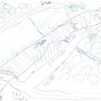
forêt
#2

value

Targets

#1

type

oa:Selector

Format

application/wkt

value

POLYGON ((71.96861 2252, 55.962451 1460, 139.994783 1452, 360.079459 1724, 484.127186 1748, 756.231878 1960, 964.311936 2012, 1064.350426 2120, 1188.398153 2136, 1224.412009 2208, 1192.399692 2276, 71.96861 2252))

styleClass

leaflet-interactive

Uncertainty

Known