Projet de numérisation du fonds cartographique du laboratoire de graphique

[Annotation #682101]

Annotation

Propriétaire

Créé

2019-04-29 16:19:10

Métadonnées

Motivated by

describing

styledBy

{"leaflet-interactive":{"stroke":"true","color":"#2ecc71","weight":"4","opacity":"0.5","fill":"true","fillColor":"","fillOpacity":"0.2","clickable":"true","smoothFactor":"1","noClip":"false","lineCap":"round","lineJoin":"round","dashArray":"","dashOffset":"","fillRule":"evenodd","interactive":"true","bubblingMouseEvents":"true","pane":"overlayPane","attribution":""}}

Bodies

#1

hasPurpose

describing

value

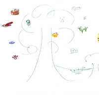
Vivance des lieux, attachement
#2

value

Targets

#1

hasSelector

type

oa:Selector

Format

application/wkt

value

POLYGON ((1017.014925 360, 1145.064192 520, 1313.128854 808, 1321.131933 992, 1001.008767 1040, 864.956421 1152, 864.956421 1416, 880.96258 1704, 968.99645 1952, 1161.07035 2136, 1417.168883 2248, 1577.230467 2264, 1785.310525 2240, 2057.415216 2160, 2265.495274 2000, 2289.504512 1808, 2289.504512 1480, 2097.430612 1232, 1793.313604 1064, 1777.307446 888, 1857.338237 704, 2017.39982 544, 2193.467562 448, 2265.495274 368, 1017.014925 360))

styleClass

leaflet-interactive

Uncertainty

Known