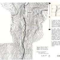
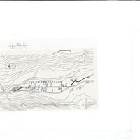
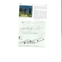
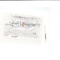
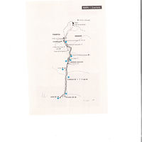
Aragón, plan topographique de Canfranc
Contenu
Titre
Aragón, plan topographique de Canfranc
Editeur
Instituto del Territorio y Urbanismo, MOPU, Casa de Velázquez
Sujet
Aucune
Couverture
Aucune
Couverture spatiale
*1:10000
Provenance
Maquette de El Camino de Santiago
Créateur
Jean Passini (CNRS – EHESS / CRH)
Résumé
Plan de Canfranc
État du document
Bon
Identifiants des documents
5984
4
_
Numéro du document
_
Support
Papier découpé et calque sur papier A3
Format
42x29,7 cm
Langue
Espagnol
Couverture temporelle
Aucune
Date de création
_
Date de publication
1985
Se conforme à
Carte topographique
Droits d’accès
Accès libre
page d’accueil
Plateforme Géomatique de l'EHESS
Ressources liées
Filtrer par propriété
| Titre | Libellé alternatif | Classe |
|---|---|---|
| [Annotation #698282] | Annotation | |
| [Annotation #699824] | Annotation |
| Titre | Libellé alternatif | Classe |
|---|---|---|
| [Annotation #714195] | Value | Annotation |
Annotations
| Value | Purpose |
|---|---|
|
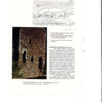
Se encuentra este pueblo en un valle estrecho cerca de la margen derecha del río Aragón, al pie del Pirineo.En el siglo XI, el rey de Aragón Ramiro I (1035-1063) cedió a la catedral de Jaca los ingresos del Campofranco , debidos a los…
|
identifying |
| Target selector | Selector type |
|---|---|
|
POLYGON ((2317.519807 2732, 2317.519807 2840, 2621.550607 2840, 2621.550607 2732, 2317.519807 2732))
|
oa:Selector |
| Value | Purpose |
|---|---|
|
Canfranc
|
identifying |
| Target selector | Selector type |
|---|---|
|
POINT (-0.52 42.71)
|
oa:Selector |