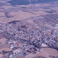
Navarra, plan topographique de Los Arcos
Contenu
Titre
Navarra, plan topographique de Los Arcos
Editeur
Instituto del Territorio y Urbanismo, MOPU, Casa de Velázquez
Sujet
Aucune
Couverture
Aucune
Couverture spatiale
*1:10000
Provenance
Maquette de El Camino de Santiago
Créateur
Jean Passini (CNRS – EHESS / CRH)
Résumé
Plan de Los Arcos
État du document
Bon
Identifiants des documents
6072
33
_
Numéro du document
_
Support
Papier découpé et calque sur papier A3
Format
42x29,7 cm
Langue
Espagnol
Couverture temporelle
Aucune
Date de création
_
Date de publication
1985
Se conforme à
Carte topographique
Droits d’accès
Accès libre
page d’accueil
Plateforme Géomatique de l'EHESS
Ressources liées
Filtrer par propriété
| Titre | Libellé alternatif | Classe |
|---|---|---|
| [Annotation #710495] | Annotation | |
| [Annotation #712070] | Annotation | |
| [Annotation #713929] | Annotation |
| Titre | Libellé alternatif | Classe |
|---|---|---|
| [Annotation #712066] | Value | Annotation |
Annotations
| Value | Purpose |
|---|---|
|
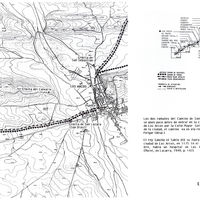
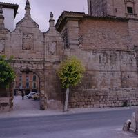
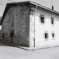
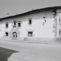
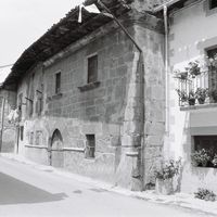
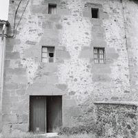
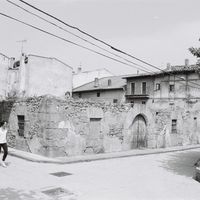
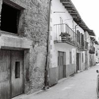
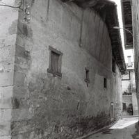
Los Arcos corresponde sin duda a la Curconio de Ptolomeo. Por consiguiente, su emplazamiento fue ocupado en una fecha muy temprana. Tras su victoria sobre los árabes en 1067, Sancho de Peñalén favoreció la instalación de los francos al…
|
identifying |
| Target selector | Selector type |
|---|---|
|
POLYGON ((1957.46145 1956, 1957.46145 2064, 2269.49306 2064, 2269.49306 1956, 1957.46145 1956))
|
oa:Selector |
| Value | Purpose |
|---|---|
| Target selector | Selector type |
|---|---|
|
POLYGON ((2068.8095 1315.978271, 2068.8095 2603.978271, 2816.448565 2603.978271, 2816.448565 1315.978271, 2068.8095 1315.978271))
|
oa:Selector |
| Value | Purpose |
|---|---|


| Target selector | Selector type |
|---|---|
|
POINT (2557.25849 1676.477661)
|
oa:Selector |