Plan du cadastre de Viscarret
Contenu
Titre
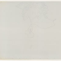
Plan du cadastre de Viscarret
Editeur
Diputación Foral de Navarra
Sujet
_
Couverture
Comune
Couverture spatiale
*1:500
Provenance
_
Créateur
Jean Passini (CNRS – EHESS / CRH)
Résumé
Plan du cadastre de Viscarret
État du document
Bon
Identifiants des documents
299
*1-1
CSNAT-0016
Numéro du document
_
Support
Tirage papier
Format
118,5x84 cm
Langue
Espagnol
Couverture temporelle
Inconnue
Date de création
_
Date de publication
_
Se conforme à
Plan cadastral
Droits d’accès
Accès libre
page d’accueil
Plateforme Géomatique de l'EHESS
Ressources liées
Filtrer par propriété
| Titre | Libellé alternatif | Classe |
|---|---|---|
| [Annotation #701238] | Value | Annotation |
| Titre | Libellé alternatif | Classe |
|---|---|---|
| [Annotation #701266] | Annotation | |
| [Annotation #701276] | Annotation |
Annotations
| Value | Purpose |
|---|---|
|
Camino de tierra
|
identifying |
| Target selector | Selector type |
|---|---|
|
LINESTRING (2545.518591 3416, 2409.504812 3240, 2393.503191 2980, 2293.49306 2824, 2205.484144 2684, 2205.484144 2528, 2245.488197 2388, 2233.486981 2244)
|
oa:Selector |
| Value | Purpose |
|---|---|
|
Viscarret
|
identifying |
| Target selector | Selector type |
|---|---|
|
POINT (-1.416771 42.967208)
|
oa:Selector |