Tianjin ditu [1860 nian (Qing Xianfeng shi nian)] 天津地图 (PLAN OF TIEN-TSIN)[1860 年 (清咸丰十年)] [Tianjin map 1860 (Emperor Qing Xianfeng 10 years)]
Contenu
Titre
Tianjin ditu [1860 nian (Qing Xianfeng shi nian)] 天津地图 (PLAN OF TIEN-TSIN)[1860 年 (清咸丰十年)] [Tianjin map 1860 (Emperor Qing Xianfeng 10 years)]
Description
Quote from the book:
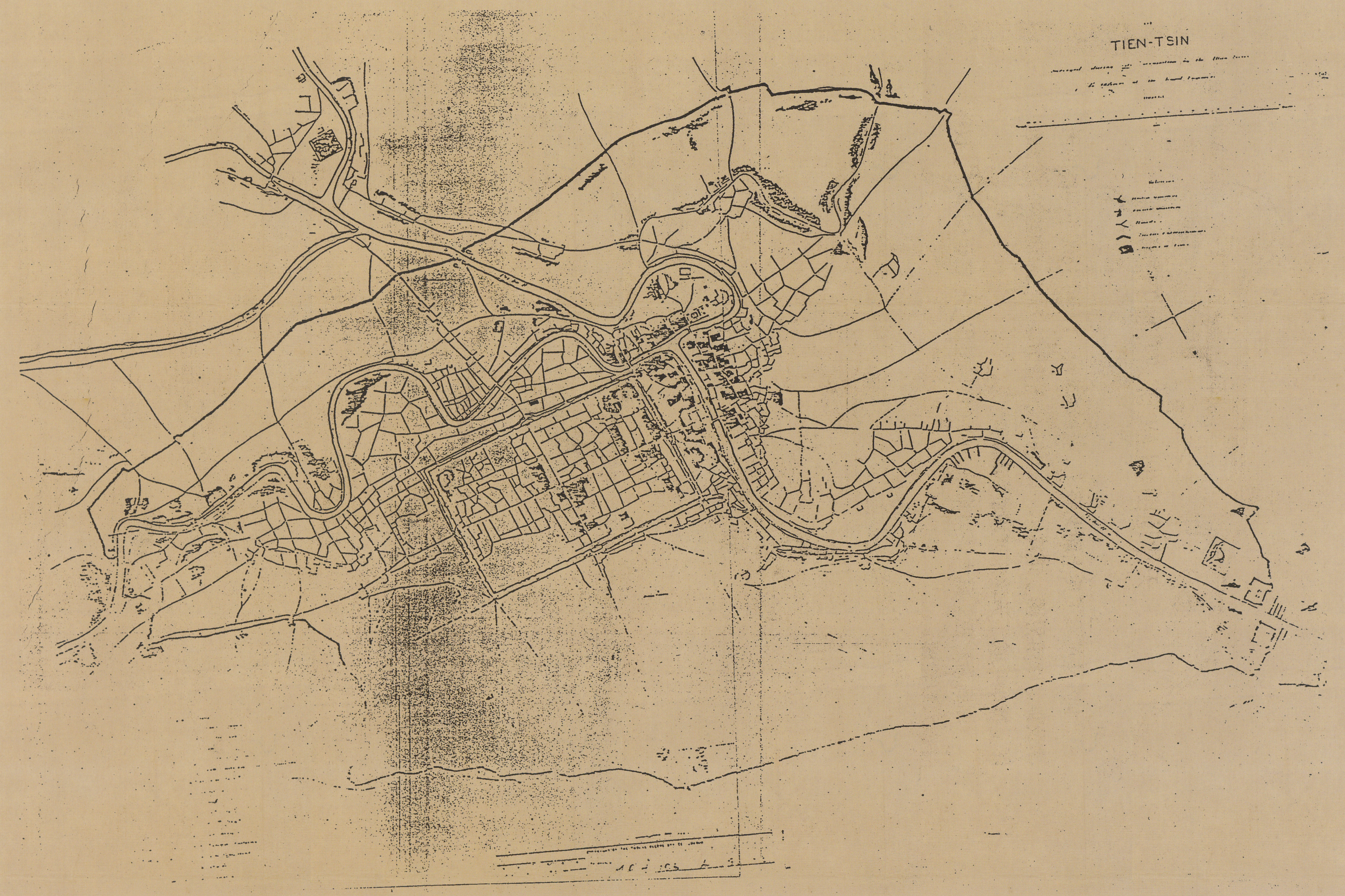
英租界是天津划定的最早的租界。英租界的规划者是英军工兵上尉戈登(C .G. Gordon)。该图是戈登等人于1860年测绘的天津城厢及最早划定英、法租界图, 也是目前发现的第一张用近代测量方法和技术绘制的天津地图,比较准确地反映了开埠前夕天津的建成面积和地理状况。据称,原图为彩色,收藏于不列颠博物馆,由于回转复制,图形和字迹已经模糊,原图规格亦不清。
英租界是天津划定的最早的租界。英租界的规划者是英军工兵上尉戈登(C .G. Gordon)。该图是戈登等人于1860年测绘的天津城厢及最早划定英、法租界图, 也是目前发现的第一张用近代测量方法和技术绘制的天津地图,比较准确地反映了开埠前夕天津的建成面积和地理状况。据称,原图为彩色,收藏于不列颠博物馆,由于回转复制,图形和字迹已经模糊,原图规格亦不清。
Identifiant
37
Black and white
numéro d’édition
Tianjin chengshi lishi dituji 1404-2004 天津城市历史地图集 1404-2004 [Tianjin City History Atlas 1404-2004]
Tianjinshi guihua he guotu ziyuan ju bianzhu 天津市规划和国土资源局编著 [Edited by Tianjin Planning and Land Resources Bureau]
ISBN 7-80696-183-109
Tianjinshi guihua he guotu ziyuan ju bianzhu 天津市规划和国土资源局编著 [Edited by Tianjin Planning and Land Resources Bureau]
ISBN 7-80696-183-109
pages
p.58-59
Numéro
23
Couverture temporelle
1860
Provenance
Buliedian bowuguan 不列颠博物馆 [British Museum]
page d’accueil
École des hautes études en sciences sociales
Licence
CC/BY/NC (for the metadata)
Collections
Annotations
There are no annotations for this resource.