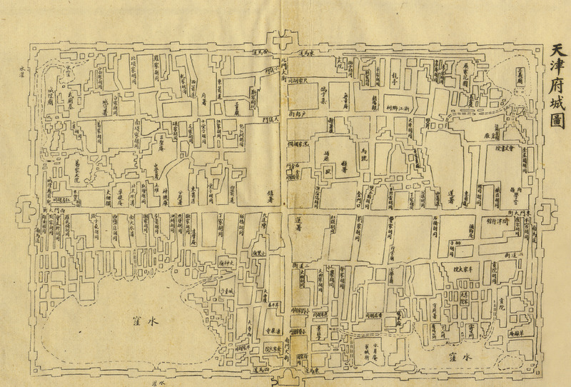
Tianjin fucheng tu [1899 nian (Qing Guangxu ershiwu nian)] 天津府城图 [1899 年 (清光绪二十五年)] [Tianjin prefectural capital map 1899 (Emperor Qing Guangxu 25 years)]
Contenu
Titre
Tianjin fucheng tu [1899 nian (Qing Guangxu ershiwu nian)] 天津府城图 [1899 年 (清光绪二十五年)] [Tianjin prefectural capital map 1899 (Emperor Qing Guangxu 25 years)]
Description
Quote from the book:
该图系光绪重修《天津府志》卷二十三《城乡》之附图,与刊于 1860年(道光二十六年)《津门保甲图说》中之“县城内图”相比较,城角各水坑周围多已扩展为居民区。原图规格为 280mm x 180mm。
该图系光绪重修《天津府志》卷二十三《城乡》之附图,与刊于 1860年(道光二十六年)《津门保甲图说》中之“县城内图”相比较,城角各水坑周围多已扩展为居民区。原图规格为 280mm x 180mm。
Identifiant
46
Black and white
Chinese
numéro d’édition
Tianjin chengshi lishi dituji 1404-2004 天津城市历史地图集 1404-2004 [Tianjin City History Atlas 1404-2004]
Tianjinshi guihua he guotu ziyuan ju bianzhu 天津市规划和国土资源局编著 [Edited by Tianjin Planning and Land Resources Bureau]
ISBN 7-80696-183-118
Tianjinshi guihua he guotu ziyuan ju bianzhu 天津市规划和国土资源局编著 [Edited by Tianjin Planning and Land Resources Bureau]
ISBN 7-80696-183-118
Guangxu chongxiu《Tianjin fu zhi》juan ershisan《chengxiang》zhi futu 光绪重修《天津府志》卷二十三《城乡》之附图 ["Tianjin records" revised version under Guangxu volume 23 "City and Countryside"]
pages
p.72-73
Numéro
28
Couverture temporelle
1899
Format
280mm x 180mm
page d’accueil
École des hautes études en sciences sociales
Licence
CC/BY/NC (for the metadata)
Collections
Annotations
There are no annotations for this resource.
