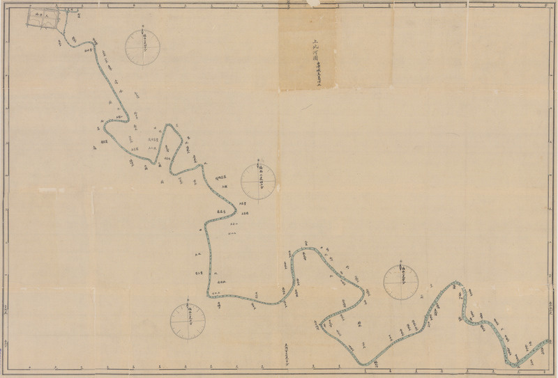
Shang bei he tu 上北河图 [Upper North River map]
Contenu
Titre
Shang bei he tu 上北河图 [Upper North River map]
Description
Quote from the book:
附:上北河图 北河下图:“上北河图” 与“北河下图” 是迄今发现较早的两幅用西法测量、 绘制的中文海河干流图, 分上图、下图两幅。“上北河图”由津城至葛沽止,“北河下图”由海口至葛沽止,并标有两岸主要地名一百余处,河身中的数字信息,很可能就是满潮时海河中心航道的深度。该边框均标有以英国格林威治天文台为基准的经纬度,测望台即设于裁湾前三贫河口之望海楼。当时,由于海河连年淤塞,严重影响了轮船的驶入和天津对外贸易的发展,治理海河成为当务之急,海河的测绘工作自然被提到日程上来。
按:“北河”在一般文献或口语中系指北运河,(乾隆)《天津县志》引《畿辅通志》 : 白河即北运河”,但在英语中“Pei Ho”则指海河,旧译为“北河”或“白河”,这是因为在外国人眼里,海河干流系北运河汇人南运河而形成 日语称海河为“白河",当系英语转译而来。此图或系转绘自外国人的测绘图,故称海河为“北河”。
“上北河图”与“北河下图”现藏国家图书馆,原图规格均为700mm x 1070mm。
Identifiant
49
Coloured
Chinese
numéro d’édition
Tianjin chengshi lishi dituji 1404-2004 天津城市历史地图集 1404-2004 [Tianjin City History Atlas 1404-2004]
Tianjinshi guihua he guotu ziyuan ju bianzhu 天津市规划和国土资源局编著 [Edited by Tianjin Planning and Land Resources Bureau]
ISBN 7-80696-183-121
Tianjinshi guihua he guotu ziyuan ju bianzhu 天津市规划和国土资源局编著 [Edited by Tianjin Planning and Land Resources Bureau]
ISBN 7-80696-183-121
pages
p.74; p.76
Numéro
29
Couverture temporelle
1899
Format
700mm x 1070mm
Provenance
Guojia tushuguan 国家图书馆 [National library]
page d’accueil
École des hautes études en sciences sociales
Licence
CC/BY/NC (for the metadata)
Collections
Annotations
There are no annotations for this resource.
