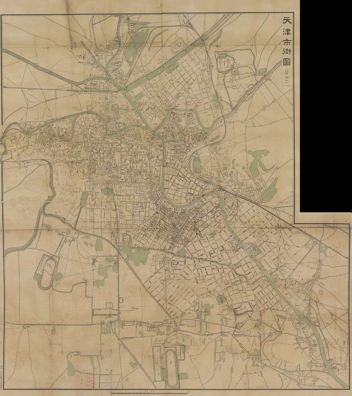
Tianjinshi jie tu [1927 nian (Zhonghua Minguo shiliu nian)]天津市街图 [1927 年 (中华民国十六年)] [Tianjin streets map 1927 (Year 16 of the Republic of China)]
Contenu
Titre
Tianjinshi jie tu [1927 nian (Zhonghua Minguo shiliu nian)]天津市街图 [1927 年 (中华民国十六年)] [Tianjin streets map 1927 (Year 16 of the Republic of China)]
Description
Quote from the book:
这是一幅绘制于 1927年 5月的天津地图,绘制者为日本的陆地测量部。本图绘制详细,特别是对天津老城、城厢地区及河北新区,编绘尤详,主要的街道里巷均标出名称。图中显示南、北运河虽经裁湾,但旧河道尚未填平。
自中日甲午战争后, 日本在天津划定租界。八国联军侵华战争后, 日本又大量向天津派出驻军。 其军事情报部门在天津活动频繁,目的是利用天津的优势地位,使其成为日后发动侵华战争的桥头堡和兵站基地。
该图现藏天津图书馆,原图规格为 1050mm x 900mm。
这是一幅绘制于 1927年 5月的天津地图,绘制者为日本的陆地测量部。本图绘制详细,特别是对天津老城、城厢地区及河北新区,编绘尤详,主要的街道里巷均标出名称。图中显示南、北运河虽经裁湾,但旧河道尚未填平。
自中日甲午战争后, 日本在天津划定租界。八国联军侵华战争后, 日本又大量向天津派出驻军。 其军事情报部门在天津活动频繁,目的是利用天津的优势地位,使其成为日后发动侵华战争的桥头堡和兵站基地。
该图现藏天津图书馆,原图规格为 1050mm x 900mm。
Identifiant
61
Coloured
Chinese
numéro d’édition
Tianjin chengshi lishi dituji 1404-2004 天津城市历史地图集 1404-2004 [Tianjin City History Atlas 1404-2004]
Tianjinshi guihua he guotu ziyuan ju bianzhu 天津市规划和国土资源局编著 [Edited by Tianjin Planning and Land Resources Bureau]
ISBN 7-80696-183-133
Tianjinshi guihua he guotu ziyuan ju bianzhu 天津市规划和国土资源局编著 [Edited by Tianjin Planning and Land Resources Bureau]
ISBN 7-80696-183-133
pages
p.98-99
Numéro
40
Couverture temporelle
1927
Date de publication
May 1927
Editeur
Riben de ludi celiang bu 日本的陆地测量部 [Japan land survey department]
Sujet
Tianjin chengshi 天津城市 [Tianjin City]
Format
1050mm x 900mm
Provenance
Tianjin tushuguan 天津图书馆 [Tianjin library]
Créateur
Riben de ludi celiang bu 日本的陆地测量部 [Japan land survey department]
page d’accueil
École des hautes études en sciences sociales
Licence
CC/BY/NC (for the metadata)
Couverture spatiale
Collections
Annotations
There are no annotations for this resource.
